
Drawing Tools Field
The Drawing Tools Field adds a configurable drawing interface to a linked Gravity Geolocation Map Field. Visitors can create and manage multiple markers, polylines, polygons, rectangles, circles, and freehand shapes while the field saves the complete drawing collection with the Gravity Forms entry.
Drawing Tools Field Overview
The Drawing Tools Field is the controller and data container for map drawing. It does not create a separate map. Instead, it connects to an existing Map Field and places its controls either inside the form or as a toolbar inside that map.
Each drawing can include its geometry, color, label, and measurements. The field can also keep totals for a collection of shapes, making the saved entry useful for service areas, delivery zones, property boundaries, route sketches, coverage maps, and other geometry-based workflows.
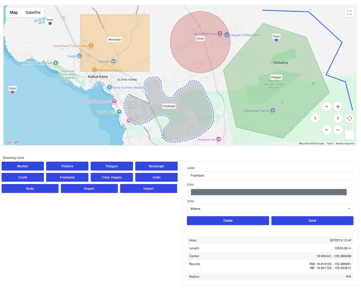
Let visitors draw and manage shapes on a linked Gravity Geolocation map.
Required Fields
Add a Google Map Field to the same form before configuring the Drawing Tools Field. The Drawing Tools Field must be linked to that map. Add one or more Drawing Shape Fields only when you also need individually configured predefined shapes.
Drawing Tools Field Settings
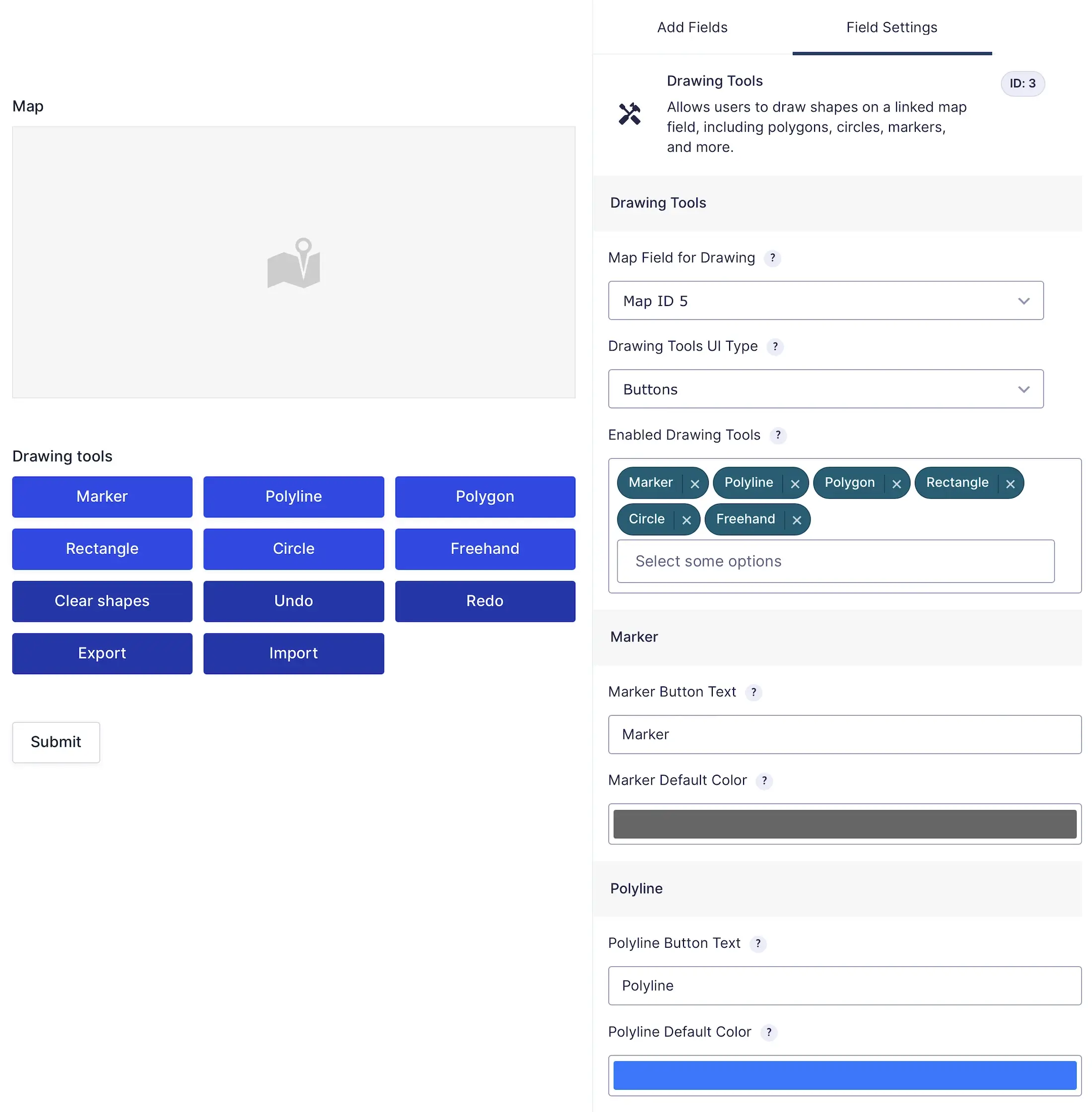
Choose the linked Map Field, interface style, and enabled drawing tools.
Predefined Shapes and Import/Export
The Drawing Tools Field can start empty or load a predefined drawing collection. A simple way to create reusable predefined data is:
- Enable the Export action and build the desired shapes on a test form.
- Export the drawing JSON.
- Paste that JSON into Predefined Shapes (JSON) in the form editor.
- Save and reload the form to verify the shapes, colors, labels, and measurements.
The Copy JSON action copies the current drawing data, while Export downloads it for reuse. Import lets a visitor load a compatible exported drawing collection into the current form.
Saved Data, Entry Output, and Merge Tags
The field saves the drawing collection as structured data. Entry details display the saved shapes on a map with collection totals. The normal merge tag uses that map-and-totals view.
Available merge-tag output modifiers include:
mapfor the saved shapes on a map.metricsfor a list of per-shape measurements.totalsfor collection totals.map_totalsfor the map and totals together.json,serialized,serialized_pretty, ortextfor data-oriented output.
Append the modifier to the field ID in the merge tag, for example {Drawing Tools:12.totals}.
Basic Setup
- Add and configure a Map Field.
- Add the Drawing Tools Field and select that map in Map Field for Drawing.
- Choose the toolbar type and position.
- Select the shapes and actions visitors should be allowed to use.
- Configure labels, colors, and optional predefined drawing JSON.
- Save the form and test drawing, editing, undo/redo, clearing, and form submission.
Troubleshooting
- The tools appear but do not draw: Confirm that the correct Map Field is selected and visible when the form loads.
- The toolbar is missing: Make sure at least one drawing tool is enabled and that conditional logic is not hiding the field.
- Predefined shapes do not load: Use unmodified JSON created by the Drawing Tools Export action and confirm that it represents a valid collection.
- Imported data is rejected: Re-export the file from the current Drawing Tools Field version instead of using a different GeoJSON structure.