
Dynamic Geolocation Field
Introduction
The Dynamic Geolocation Field is a mode applied to a compatible native Gravity Forms field. It copies one selected value from a Gravity Geolocation source field into that native field as the source data changes.
Use it to expose a single address component, numeric distance, shape measurement, nearest-location property, or address-validation result for conditional logic, calculations, notifications, and other Gravity Forms workflows.
Supported Gravity Forms Fields
Dynamic Geolocation settings are available for Single Line Text, Paragraph Text, Number, Hidden, Dropdown, Multiple Choice, Checkboxes, and Address fields. Choose a destination field type appropriate for the value. For example, use a Number Field for a numeric distance used in calculations.
Dynamic Geolocation Field Options
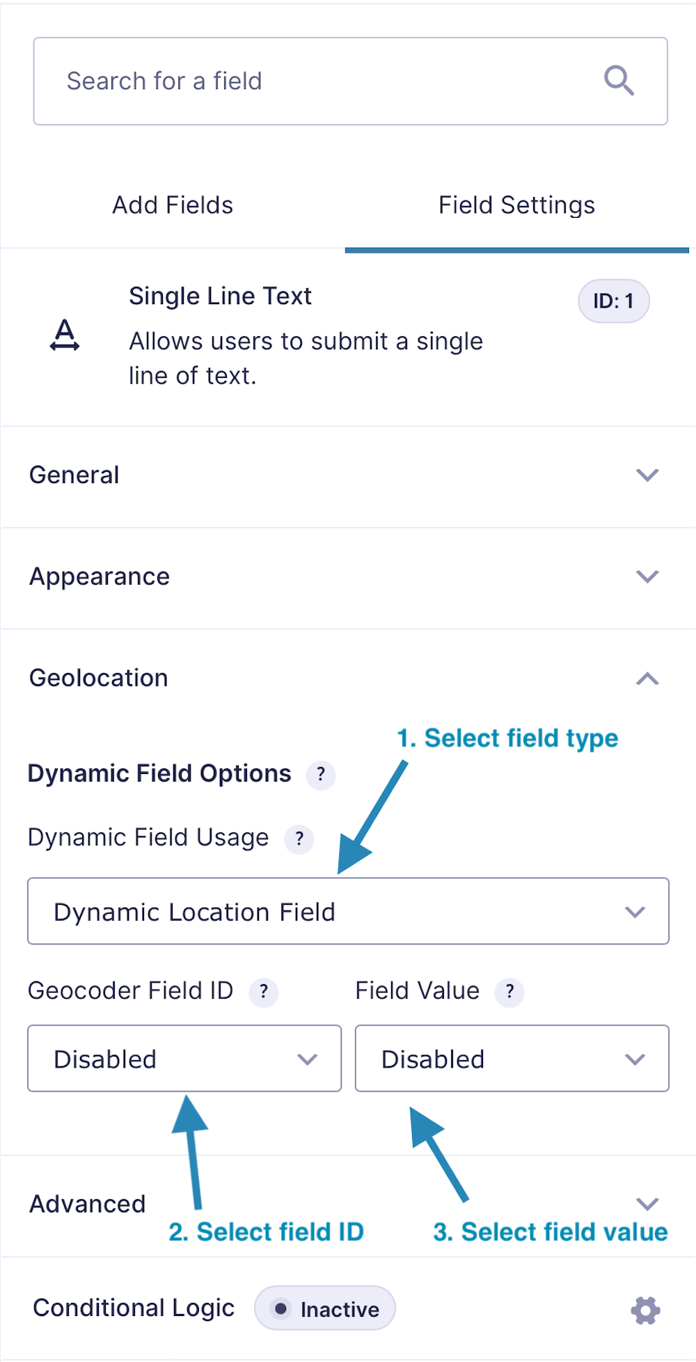
The Seven Dynamic Modes
1. Location
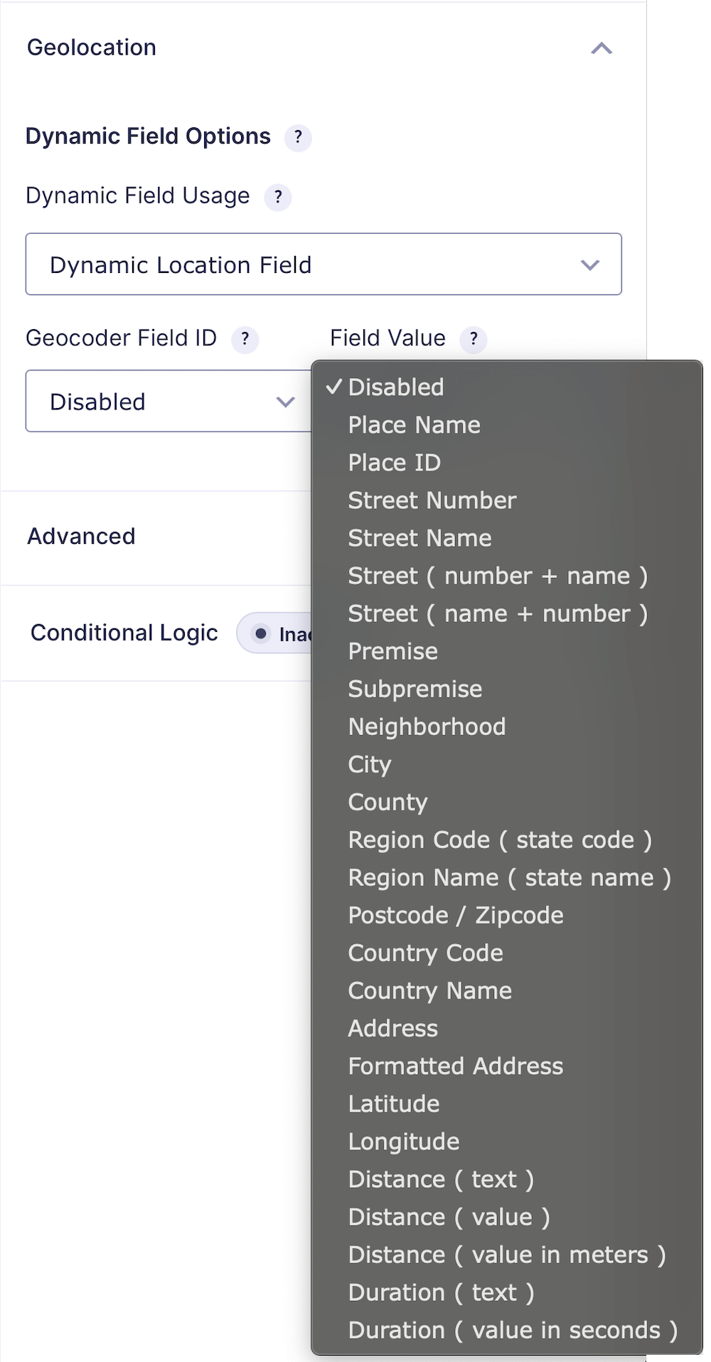
Select a Geocoder Field and return one location property, including street components, city, county, region, postcode, country, place name, Place ID, formatted address, latitude, longitude, combined coordinates, or serialized location data.
2. Directions
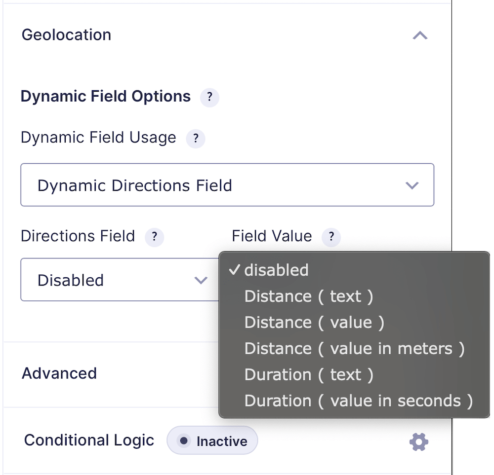
Select a Directions Field and return distance text, numeric distance, distance in meters, duration text, or duration in seconds.
3. Distance
Select a Distance & Duration Field and return the same distance or duration values available in Directions mode.
4. Drawing Tools
Select a Drawing Tools Field and return total area, total line length, total perimeter, collection bounds, shape count, shape types, label summary, or all shapes as serialized JSON.
5. Drawing Shape
Select a Drawing Shape Field and return its area, perimeter, line length, radius, center, bounds, label, fill color, shape mode, or geometry type.
6. Nearest Locations
Select a Nearest Locations Field and enter the property to return from the selected location. This can be a built-in property such as address, distance, or duration, or a custom column included in the destination data.
7. Address Validation
Select an Address Validation Field and return Status, Outcome, Delivery Status, Selected Address, Suggested Address, Selected Type, Region Code, or Geocoder ID.
Gravity Forms Calculation Example
To calculate a delivery fee from distance:
- Add and configure a Distance & Duration Field.
- Add a Gravity Forms Number Field.
- Set its Field Usage to Distance, choose the source field, and select Distance (value).
- Use that populated Number Field in another Gravity Forms calculation, such as distance multiplied by a per-mile rate.
The Dynamic Geolocation feature populates the source number; Gravity Forms performs the calculation.
How to Use Dynamic Geolocation Fields
- Add and configure the Gravity Geolocation source field.
- Add a supported native Gravity Forms destination field.
- Select the Dynamic Geolocation Field usage, source, and output value.
- Preview the form and trigger the source field.
- Confirm that the destination value updates and is saved with the entry.