Solutions
Gravity Search
FEATURED
Search, filter, and display Gravity Forms entries
Gravity Fields
Collect location data using native Gravity Forms fields
Gravity Validation
Validate, standardize, and verify addresses
Gravity Directions
Calculate routes, distance, and travel time
Gravity Nearby
Find the closest locations by distance or travel time
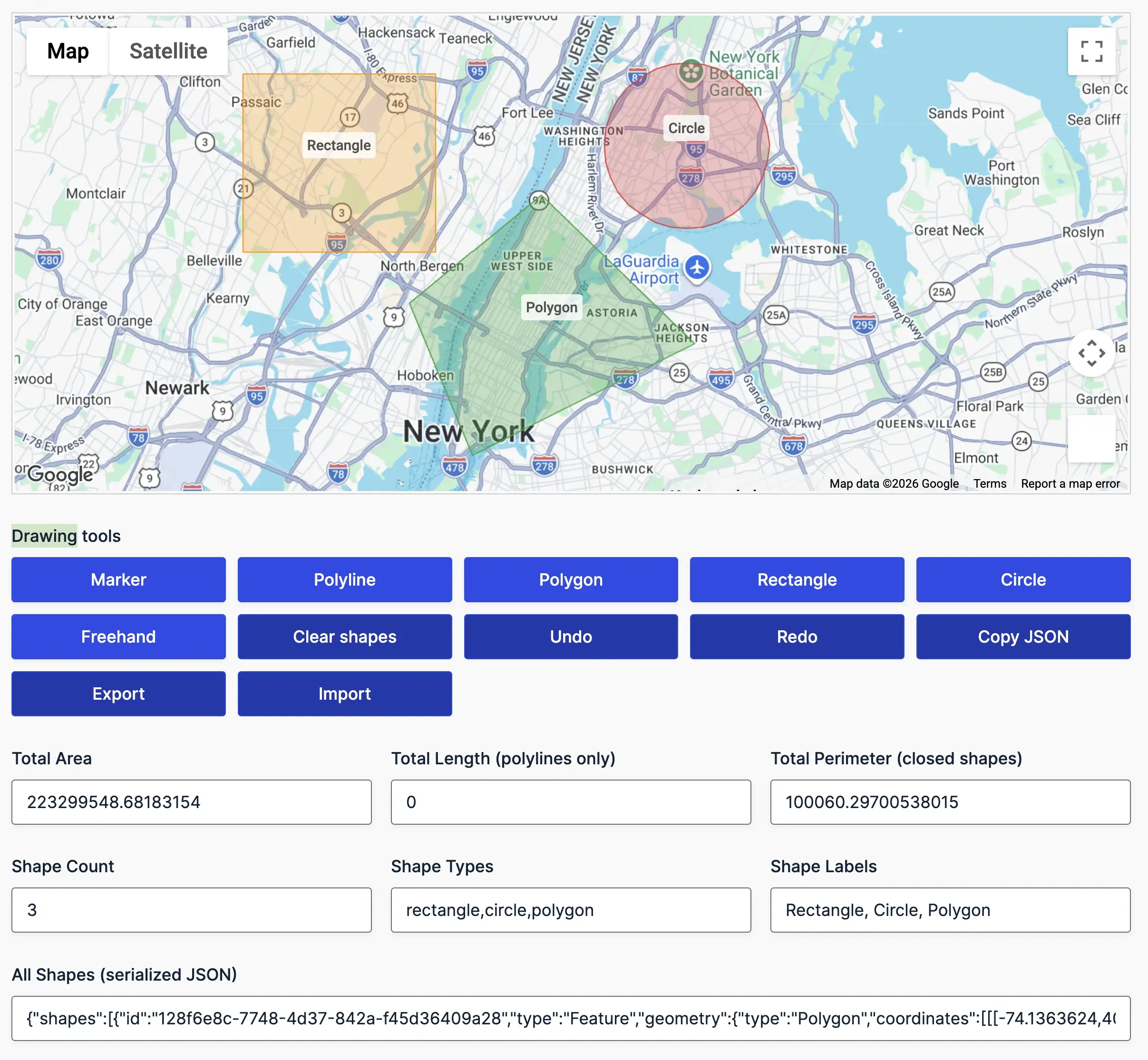
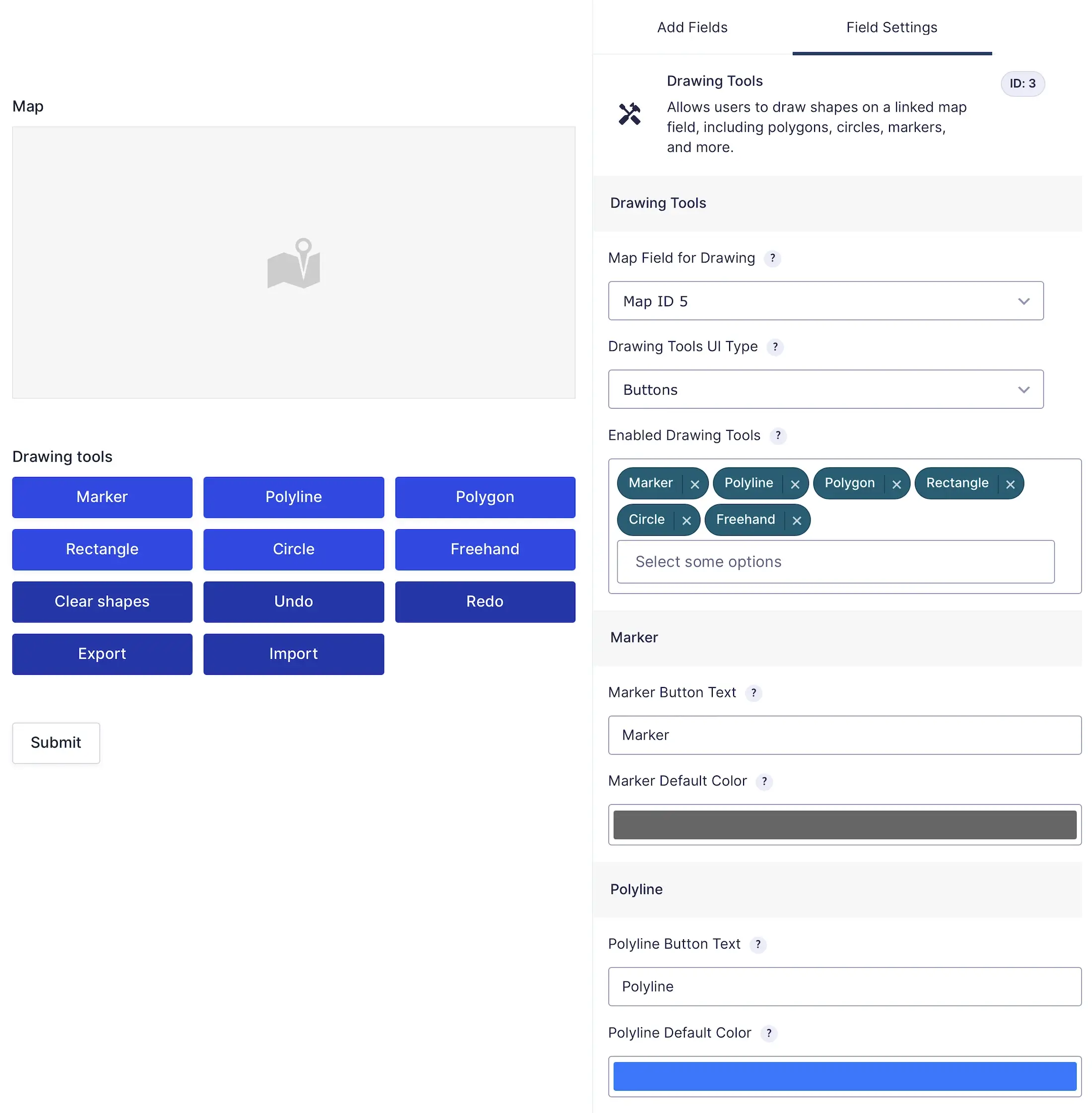
Gravity Draw
FEATURED
Draw service areas, delivery zones, and boundaries
Use Cases
Gravity Search
Turn Gravity Forms into searchable directories
Use Cases
See what you can build with Gravity Search