
Addresses are useful for people, but many location-aware workflows ultimately need latitude and longitude. Coordinates let you place a marker precisely, save a job site that does not have a conventional street address, pass a location to another system, or perform map and proximity operations later.
Gravity Location can capture coordinates directly inside Gravity Forms. The visitor can enter them manually, select a place through address autocomplete, move a marker on a map, or use the browser’s current-location feature. Connected geolocation fields remain synchronized, even when you position them in different parts or pages of the form.
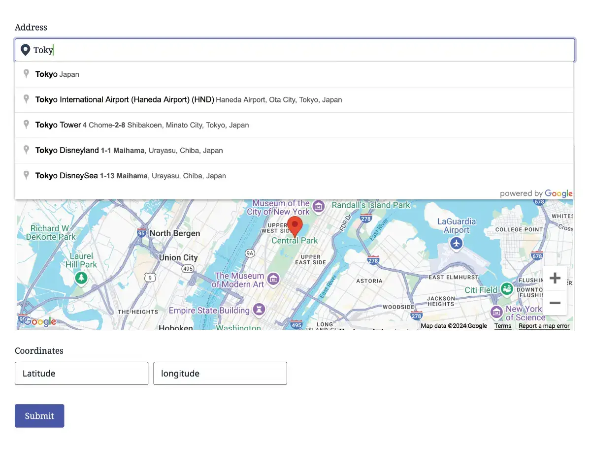
Four Ways to Collect Coordinates
The best input method depends on what your visitors know and how precise the location must be.
- Address autocomplete: the visitor selects a recognized address and the form captures its coordinates automatically.
- Map selection: the visitor clicks or moves a marker to identify the exact location visually.
- Current location: the visitor grants browser permission and the form uses the device-reported location.
- Manual coordinates: the visitor enters a known latitude and longitude directly.
You can offer one method or combine several. For example, a customer can begin with an address and then move the marker to the correct entrance, loading bay, trailhead, or service point.
How the Fields Work Together
A location workflow is coordinated through the Geocoder Field. The Geocoder Field is hidden on the frontend by default and stores the shared location state used by connected fields.
Link the Address, Map, Coordinates, and Locator Button fields to the same Geocoder Field. When one connected field changes the location, the others receive the updated location data. The fields do not need to sit beside each other: they can appear in different sections or on different pages of a multi-page Gravity Form and still remain connected.
This field-based structure lets you design the form around the visitor’s workflow instead of forcing the address, map, and coordinates into one fixed interface.
Step 1: Add the Hidden Geocoder Field
Open the form in the Gravity Forms editor and add a Geocoder Field. You usually do not need to display anything for this field on the frontend. Its role is to geocode locations and synchronize the fields connected to it.
If the form should begin at a known location, configure default latitude and longitude in the Geocoder Field settings. Default coordinates can trigger geocoding when the form loads, while the separate marker defaults can position a map marker without changing the other connected values.
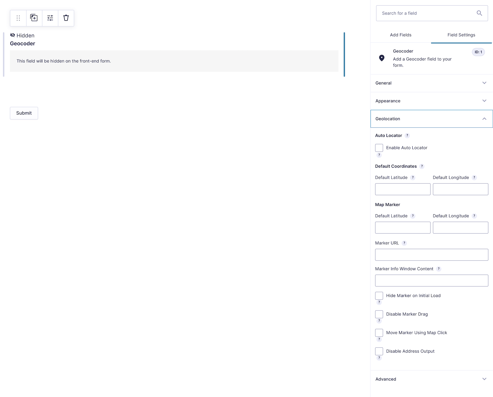
See the Geocoder Field documentation for the complete settings.
Step 2: Add the Coordinates Field
Add a Coordinates Field and select the Geocoder Field you created. The field provides separate latitude and longitude inputs whose labels and placeholders can be customized.
Decide whether the visitor should edit the coordinates directly:
- Keep the field visible when users may know the exact coordinates or need to fine-tune them.
- Use address or map input as the primary interface when coordinates are mainly stored for maps, integrations, or later processing.
- Populate standard or hidden Gravity Forms fields with latitude and longitude through Dynamic Location Data when another calculation, feed, or add-on needs those values separately.
The dedicated Coordinates Field is especially useful for properties, field-service locations, land and environmental records, outdoor destinations, incident reports, and sites without reliable street addresses.
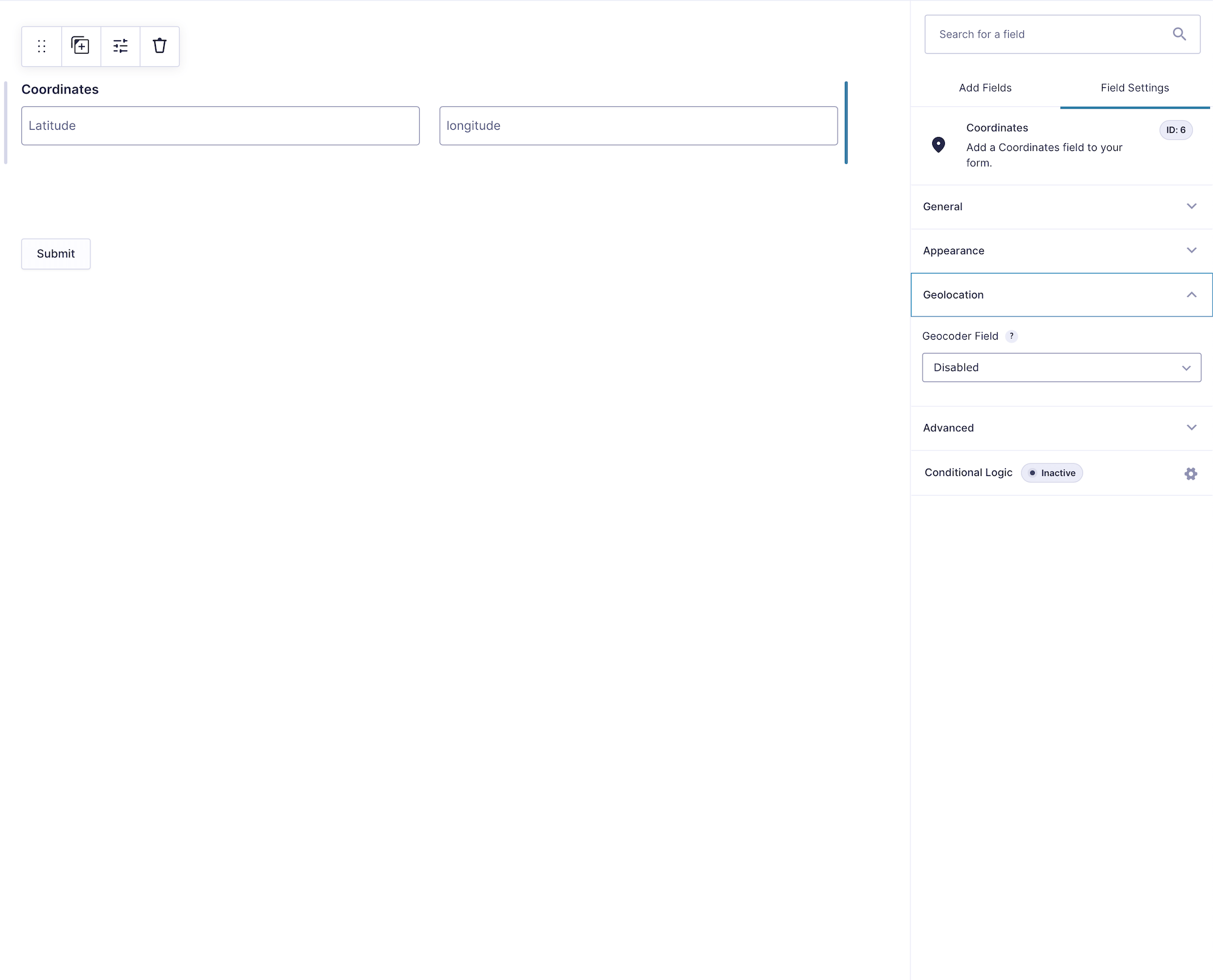
See the Coordinates Field documentation for its settings.
Step 3: Choose the Visitor’s Location Input
Capture Coordinates from an Address
Add an Address Field, connect it to the same Geocoder Field, and enable Google Places autocomplete. When the visitor selects an address, the location is geocoded and the connected Coordinates Field updates automatically.
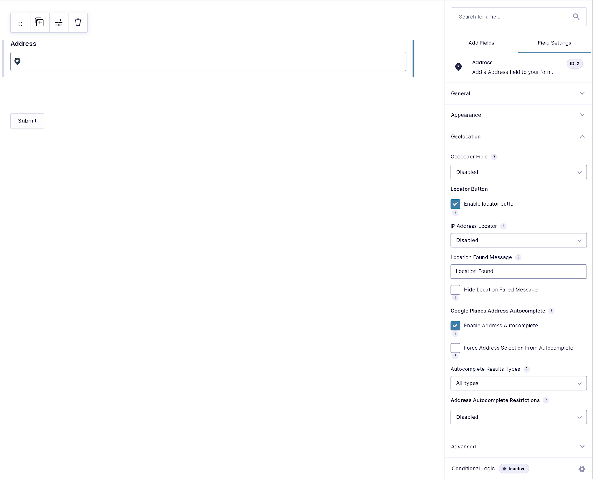
This is the most familiar workflow for deliveries, contact forms, appointments, property records, and other address-based submissions.
Let the Visitor Select a Point on a Map
Add a Map Field and connect it to the Geocoder Field. Depending on your map settings, the visitor can select a location by clicking the map or moving its marker. The updated marker position synchronizes back to the Coordinates Field.
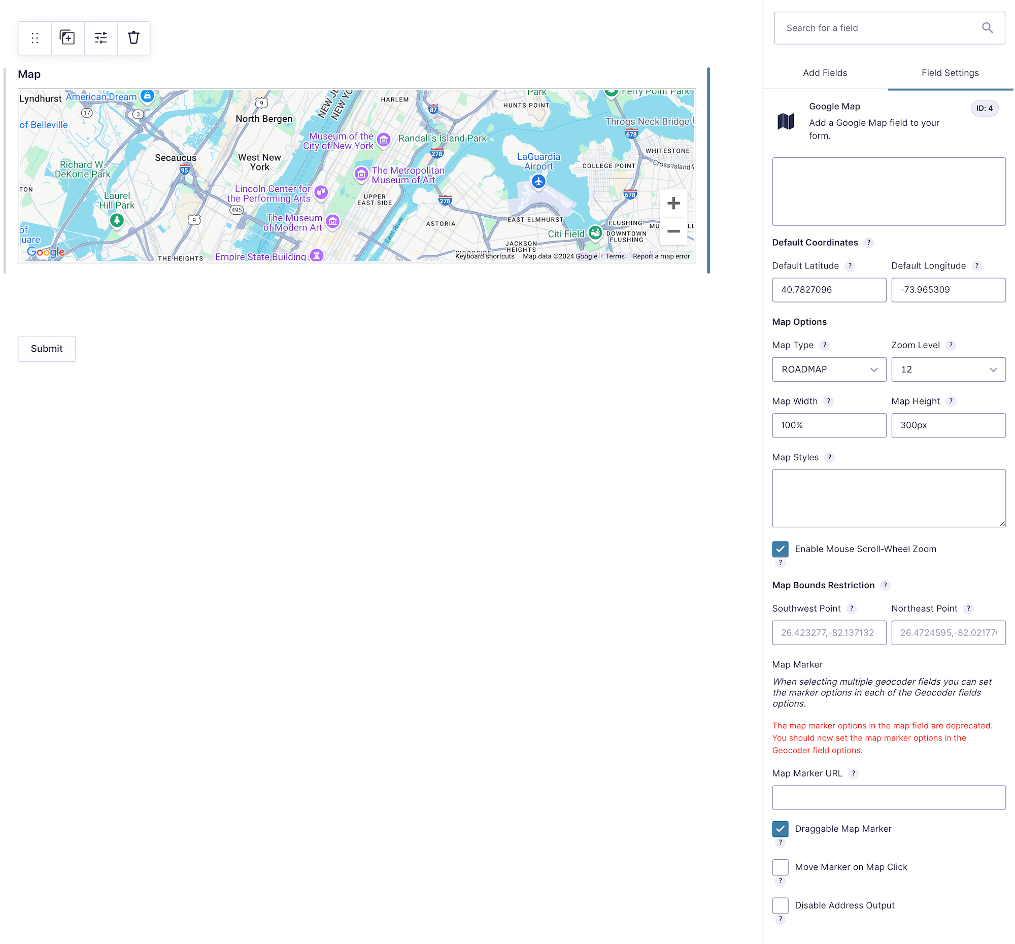
A map is valuable when the street address identifies a general area but the precise point matters. Examples include a building entrance, construction location, parking area, pickup point, or utility asset.
Detect the Visitor’s Current Location
Add a Locator Button Field connected to the same Geocoder Field, or configure automatic location detection when that behavior is appropriate. The visitor’s browser will request permission before sharing the device location.
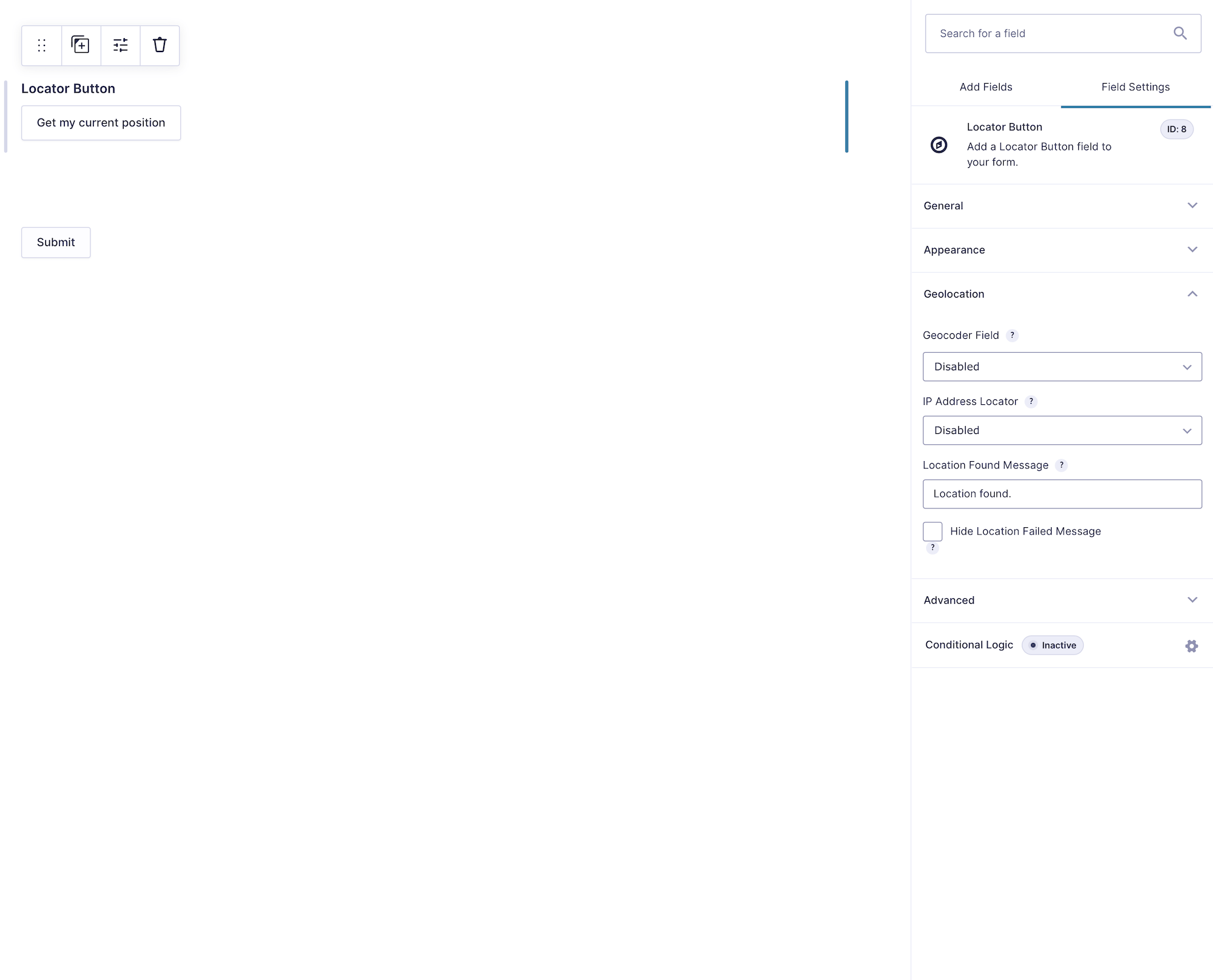
Current-location accuracy depends on the device, browser, connection, permissions, and available positioning data. Allow the visitor to review or adjust the result rather than assuming every device reports the exact point.
Accept Coordinates Directly
When users already have coordinates, the Coordinates Field can be the primary input. Entering latitude and longitude can update the connected map and retrieve related address information through reverse geocoding.
Step 4: Make Coordinates Available to Other Workflows
The Coordinates Field saves the submitted values with the Gravity Forms entry. When another Gravity Forms field needs a single latitude or longitude value, configure Dynamic Location Data on a compatible field and select the connected Geocoder Field as its source.
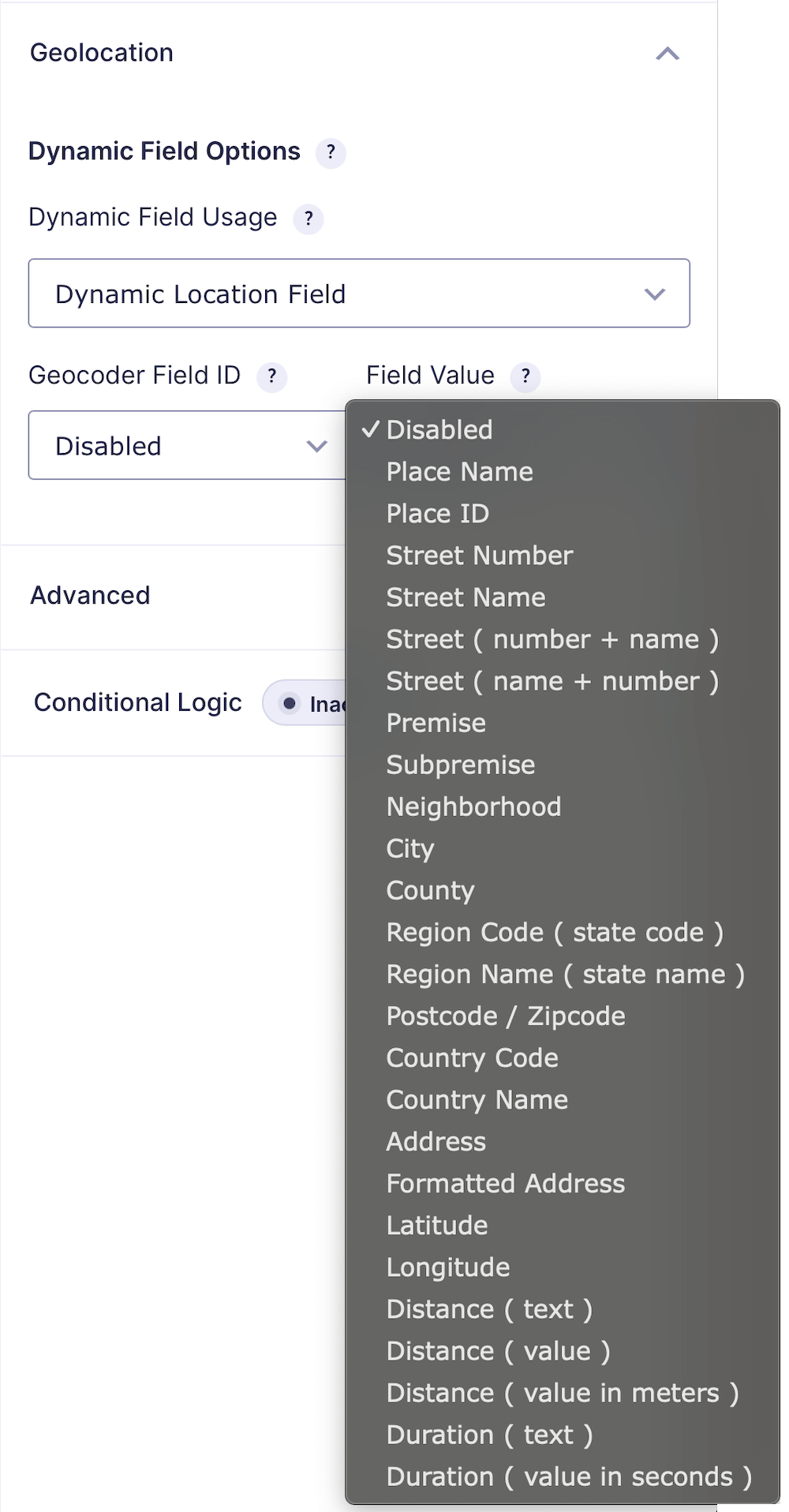
Separate latitude and longitude values can then participate in:
- Notifications and confirmations
- Merge tags and exports
- Webhooks, CRM feeds, and other Gravity Forms add-ons
- Custom integrations and external APIs
- Administrative calculations or conditional workflows
Keep a clear distinction between display text and numeric data. A formatted address is ideal for people, while latitude and longitude should remain clean coordinate values for systems that need to process them.
See the Dynamic Geolocation Field documentation for supported field types and location outputs.
Step 5: Test Accuracy and Synchronization
Preview the completed form and test every location-input method you enabled. Confirm that:
- Selecting an address updates the coordinates and marker.
- Moving or clicking the marker updates the coordinates.
- Entering coordinates moves the marker to the expected point.
- The Locator Button handles both accepted and denied browser permission.
- Fields on separate form pages still reflect the current location.
- The saved Gravity Forms entry contains the expected values.
- Notifications, exports, and connected feeds receive the correct coordinate format.
Test on desktop and mobile devices. Mobile location detection may be more precise than desktop detection, while manually moving a marker may require extra attention on a small touchscreen.
Frequently Asked Questions
Can Gravity Forms get coordinates from an address?
Yes. Connect an Address Field and Coordinates Field to the same Geocoder Field. When the address is selected and geocoded, the latitude and longitude update automatically.
Can users select coordinates on a map?
Yes. A connected Map Field can allow visitors to select or refine a location using the marker. The Coordinates Field stays synchronized with the selected point.
Can I keep latitude and longitude hidden?
Yes. Visitors can interact with an address, map, or Locator Button while coordinates are captured behind the scenes. Dynamic Location Data can also populate compatible hidden or standard Gravity Forms fields when another workflow needs separate values.
Do all geolocation fields have to appear together?
No. Connected geolocation fields can appear anywhere in the form, including on different pages of a multi-page form, while continuing to share the same location state.
Which package includes coordinate collection?
The Address, Geocoder, Coordinates, Map, Locator Button, Reset Location, and Dynamic Location Data features are available in Gravity Location, Gravity Geolocation Toolkit, and All Access.
Add Coordinates to Your Gravity Forms
Gravity Location gives visitors several natural ways to identify a place while keeping the address, map, and coordinate data synchronized behind the form.