
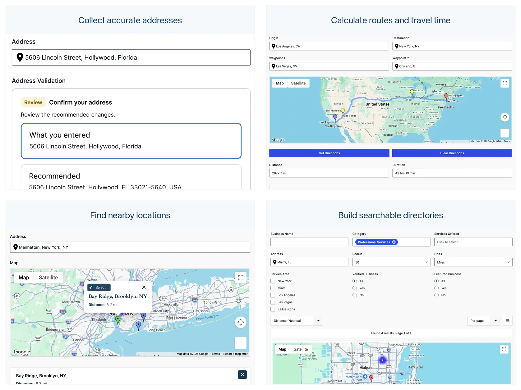
Gravity Geolocation can help you:
- Collect and validate accurate locations.
- Calculate distance, travel time, and routes.
- Find nearby locations or draw service areas.
- Display saved entries on maps and searchable directories.
Adding location awareness to Gravity Forms is useful when the location affects what happens next—not merely when you want to store an address. A form can validate the delivery destination, calculate a fee, show a route, find the nearest provider, or turn saved submissions into an interactive directory.
These examples show how Gravity Geolocation and Gravity Search can support practical business and community workflows without requiring a custom location platform.
1. Collect accurate addresses and coordinates
Use Gravity Geolocation fields to collect a structured address, coordinates, a location selected on a map, or the visitor’s current position. A Geocoder Field can synchronize connected location fields so the entry stores the components your workflow needs.
Useful for: bookings, service requests, property submissions, event venues, job applications, and customer records.
Explore the Gravity Forms geolocation fields or follow the geolocation-enabled form tutorial.
2. Validate and standardize submitted addresses
When a deliverable or verified address matters, the Address Validation Field can ask the user to confirm a Google-validated result or correct the address before submission. This can reduce spelling variations, incomplete addresses, and locations that cannot be used later.
Useful for: deliveries, registrations, shipping requests, property records, and any workflow where staff otherwise need to correct addresses manually.
See the Address Validation solution.
3. Calculate delivery fees, mileage, or service eligibility
The Distance & Duration Field calculates road distance and travel time or direct straight-line distance between two saved locations. Populate a numeric result into a supported Gravity Forms field when it should participate in normal calculations or conditional logic.
Useful for: delivery pricing, mileage reimbursement, service-radius checks, appointment planning, and travel estimates.
Read Calculate Distance and Travel Time in Gravity Forms.
4. Show routes and step-by-step directions
The Directions Field builds a complete route from an origin to a destination, with optional waypoints. It can draw the route on a Map Field and send its turn-by-turn instructions to a Directions Panel.
Useful for: transportation bookings, delivery routes, event travel, field-service requests, and multi-stop journeys.
Explore the Distance and Directions solution.
5. Find the nearest locations
Nearest Locations fields can compare the visitor’s selected location with locations stored in a list field, taxonomy, user data, or other supported sources. Results can be ordered by distance or travel time and displayed in a field or panel.
Useful for: assigning the nearest branch, recommending providers, finding nearby facilities, routing requests, and showing pickup locations.
See the Nearest Locations solution.
6. Collect service areas and geographic shapes
Drawing Tools let users create circles, rectangles, polygons, polylines, and markers on a map. The Drawing Shape Field can store and expose individual shape properties for calculations and integrations.
Useful for: delivery zones, service territories, construction areas, real-estate boundaries, coverage maps, and geographic measurements.
Explore the Drawing Tools and Shape Fields solution.
7. Display submissions on a map
The Gravity Forms Mashup Map displays valid saved entry locations as markers on one Google map. You can limit the included entries and Geocoder Fields, customize information windows and marker icons, and group nearby markers into clusters.
Useful for: property maps, community resources, project locations, event venues, service requests, and internal operations dashboards.
Follow the Mashup Map guide.
8. Build searchable directories and portals
Gravity Search turns existing Gravity Forms entries into frontend lists, grids, tables, maps, directories, and portals. Visitor search controls, location search, maps, and entry details pages are all optional, so the interface can stay as simple as the project requires.
Useful for: business directories, member directories, store locators, customer portals, property listings, and internal record searches.
Visit the Gravity Search overview and explore the Business Directory, Member Directory, Store Locator, and Customer Portal examples.
Choosing the right package
- Gravity Geolocation provides the core fields for collecting and synchronizing locations.
- Gravity Geolocation Pro adds the complete advanced field and map collection, including validation, directions, distance, nearest locations, drawing tools, Single Entry Map, and Mashup Map.
- Gravity Search is the standalone frontend entry-search and display product.
- All Access combines Gravity Geolocation Pro and Gravity Search.
Choose based on the workflow you need rather than the number of features listed. A form that only collects accurate locations may need the core package, while a directory that both collects and searches locations benefits from All Access.
Start with the user’s next decision
The most effective location forms answer a specific question: Is this address valid? How far away is it? Which provider is closest? What route should the visitor take? Which saved entries match this search?
Start with that decision, then add only the fields and displays required to support it. Explore the documentation, review the solution pages, or compare current plans.