
Once a Gravity Form has collected locations, the next question is often how to display those submissions on a map. You might need one marker on an entry profile, hundreds of submissions on a shared map, or a searchable map that updates as visitors apply filters.
Gravity Geolocation provides three distinct approaches:
- Single Entry Map for one saved entry.
- Mashup Map for multiple saved entries.
- Gravity Search maps for searchable, filtered, or predefined result sets.
Choosing the right map begins with deciding whether you are collecting a location, displaying saved locations, or building an interactive search experience.
First: The Map Field Is for Location Input
The Map Field placed inside a Gravity Form helps a visitor select or adjust a location before submitting the form. It can synchronize with an Address Field, Coordinates Field, and Geocoder Field.
That is different from displaying previously submitted entries. If you want to show saved locations after submission, use Single Entry Map, Mashup Map, or Gravity Search.
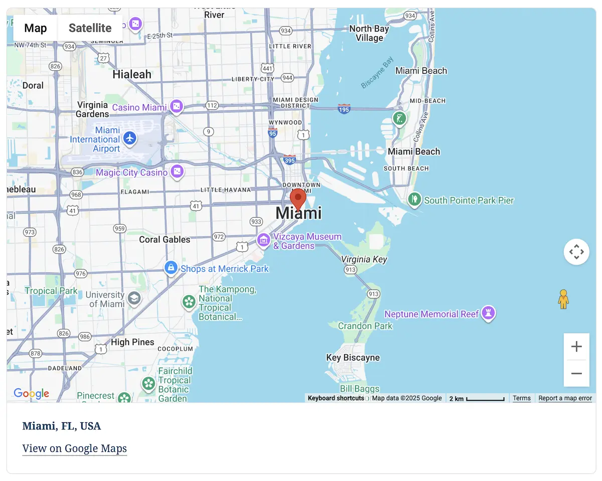
Option 1: Display One Entry with Single Entry Map
Single Entry Map displays the saved location from one specific Gravity Forms entry wherever you place the shortcode. Provide the entry ID directly, or let the shortcode resolve it from a dynamic single-entry URL. It can display selected entry information in the marker’s info window and beneath the map.
Typical uses include:
- A property, event, or business details page
- A confirmation or entry-review page
- A member or customer profile
- An inspection, appointment, or service record
- A custom template displaying one Gravity Forms submission
Use Single Entry Map whenever you need to display one known entry’s location—on a standalone page, confirmation, template, directory details page, or another dynamic frontend layout.
Option 2: Display Multiple Entries with Mashup Map
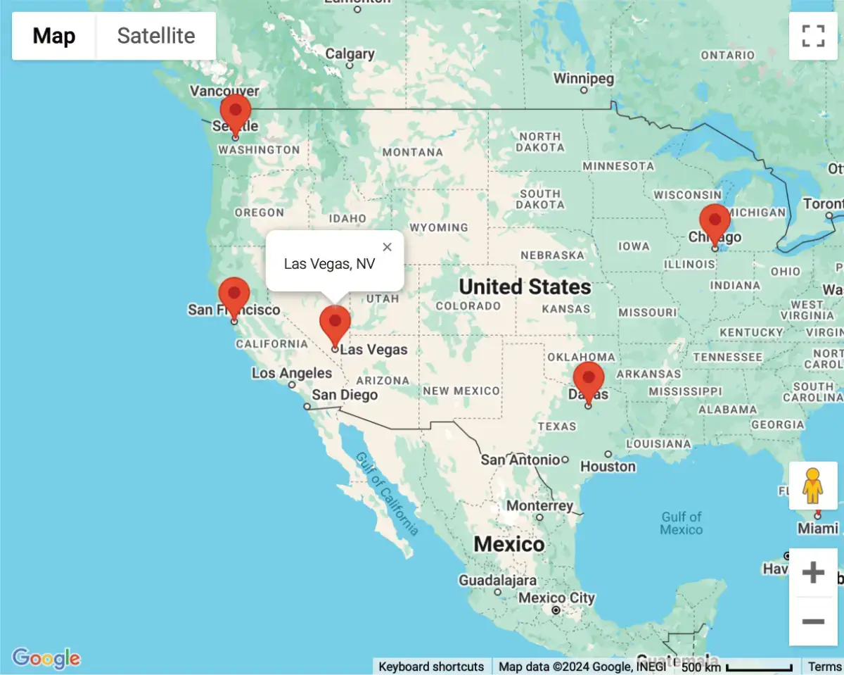
Mashup Map combines locations from multiple entries belonging to a Gravity Form and displays them as markers on one interactive map.
The shortcode can control which form supplies the entries, which entries are included or excluded, which Geocoder Fields provide locations, map dimensions and type, marker icons, and the maximum number of entries to display.
A basic map can be embedded with:
[gfgeo_mashup_map form_id="1"]Replace 1 with the Gravity Form containing the entries you want to map.
Mashup Map is suitable for:
- Event registrations
- Customer or member locations
- Submitted properties
- Project and inspection locations
- Community maps
- Business or office locations that do not require visitor filtering
Marker clustering can group dense locations so the map remains readable as the number of entries increases. Information windows can provide selected context when a visitor opens a marker.
See the Mashup Map shortcode documentation for the available attributes and examples.
Option 3: Build Searchable and Filtered Maps with Gravity Search
Mashup Map answers, “Where are these entries?” Gravity Search answers the broader question, “Which entries match what this visitor needs, and where are they?”
A Gravity Search map can display entries selected by:
- Text and keyword filters
- Gravity Forms field values
- Categories and choices
- Dates, numbers, users, and entry metadata
- Address, radius, and proximity searches
- Administrator-defined default filters
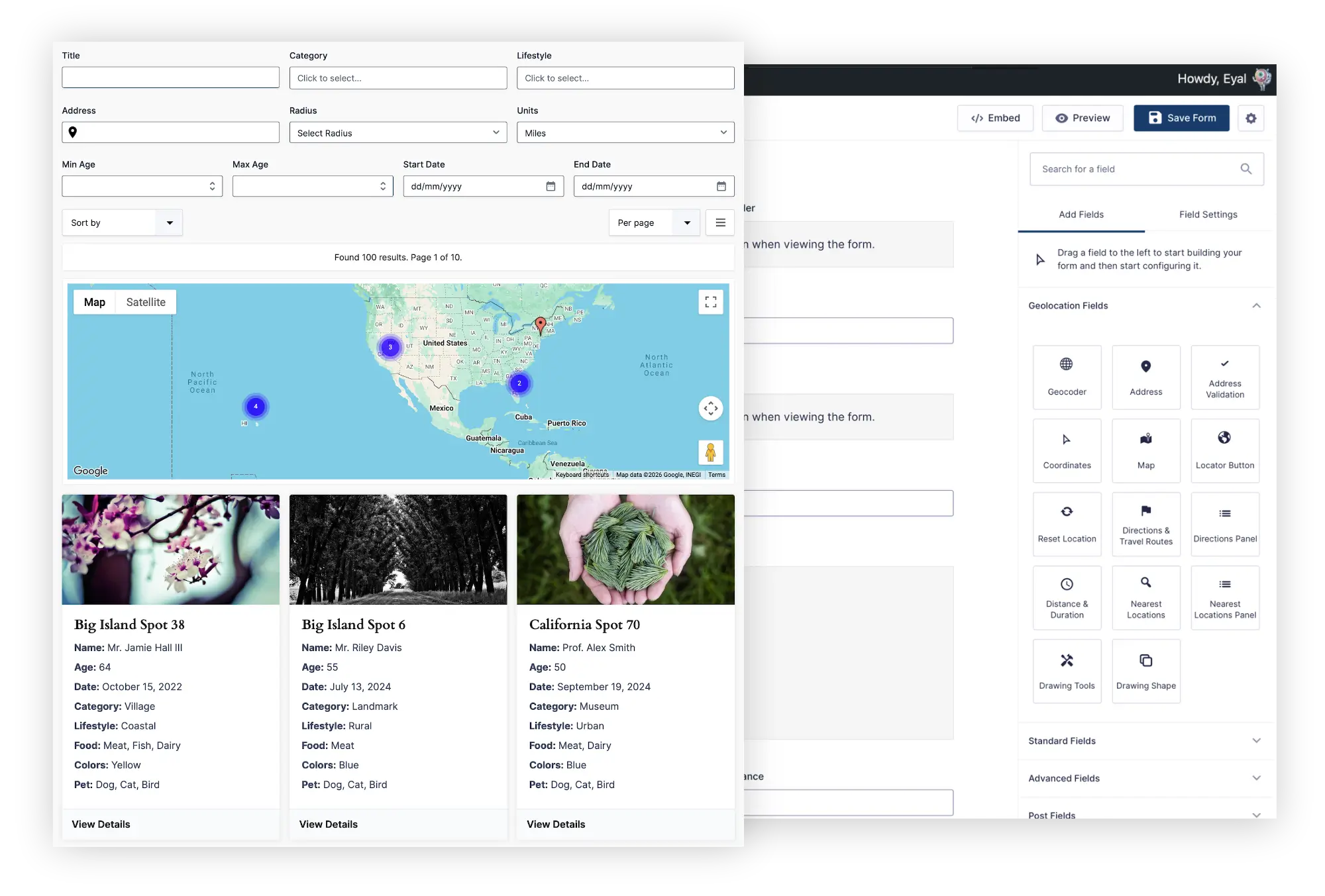
The map can appear alongside cards, lists, grids, or tables. Markers and results update together, and visitors can open dedicated details pages for individual entries.
Visible search fields are optional. You can also configure a Search that displays a predefined set of entries as a map without asking the visitor to submit a search.
Use Gravity Search for store locators, business directories, property finders, member searches, service-provider maps, customer portals, and other experiences where the displayed entries depend on filters or visitor intent.
Explore Gravity Search or read the Gravity Search overview.
Single Entry Map vs Mashup Map vs Gravity Search
| Need | Best choice |
|---|---|
| Show the location for one entry | Single Entry Map |
| Show multiple entries from one form on a map | Mashup Map |
| Let visitors search or filter mapped entries | Gravity Search |
| Show a predefined filtered map with no visible search form | Gravity Search |
| Display a simple map of submissions without results or filtering | Mashup Map |
| Show cards or a table synchronized with markers | Gravity Search |
Prepare the Gravity Forms Location Data
Every marker needs valid coordinates. For new entries, collect and geocode locations with Gravity Geolocation fields. The Geocoder Field can synchronize the address, coordinates, and form-input Map Field before the entry is saved.
If the form already contains older entries, those entries may need their locations imported or geocoded before they can participate in maps and proximity searches. Review the source addresses and API configuration before processing a large set of existing records, because geocoding external addresses can consume provider quota and incur charges.
Plan What a Marker Should Reveal
A map is most useful when a visitor understands what each marker represents. Select only the information needed for the public use case, such as:
- Business or location name
- Address
- Category or service
- Opening hours
- Featured image
- Link to the complete entry details
Do not expose private Gravity Forms entry data simply because it exists in the entry. Maps intended for customer or member data should be reviewed particularly carefully.
Use Marker Clustering for Dense Maps
When many markers occupy the same area, individual icons overlap and make the map difficult to use. Marker clustering combines nearby markers at broader zoom levels and separates them as the visitor zooms in.
Clustering improves map readability, but it does not replace filtering when the underlying dataset is large or visitors need to find a specific kind of entry. That is the point at which a Gravity Search experience may be more useful than a single all-entry map.
Test the Map on Real Pages and Devices
Before publishing:
- Confirm that every expected entry has valid coordinates.
- Check marker and information-window content for private data.
- Test pages containing hidden tabs, accordions, popups, or page-builder containers.
- Review the map at mobile widths.
- Verify that the configured Google Maps APIs and key restrictions match the live domain.
- Test high-density areas where marker clustering is most important.
Frequently Asked Questions
Can Gravity Forms entries be displayed on Google Maps?
Yes. Gravity Geolocation can display one entry with Single Entry Map or multiple submissions with Mashup Map. Gravity Search adds searchable, filtered, and synchronized result maps.
Do I need to convert entries into WordPress posts?
No. These features can work directly with Gravity Forms entries and their stored location data.
Can I display several locations stored in one entry?
The available behavior depends on the selected map and configured location sources. Gravity Search is designed to work with one or more indexed entry locations and can treat qualifying locations as distinct results and markers.
Can visitors filter the map?
Use Gravity Search when visitors need text, category, field, date, user, metadata, radius, or other supported filters. Mashup Map is intended for a more direct multi-entry display.
Which packages include entry-display maps?
Single Entry Map and Mashup Map are included in Gravity Geolocation Toolkit and All Access. Gravity Search includes its own result-map system. All Access combines both approaches.
Choose the Right Gravity Forms Map
Use Gravity Maps when you need to display one saved entry or combine submissions on a Mashup Map. Add Gravity Search when visitors need to search, filter, sort, or explore those entries through synchronized results and maps.
Explore Gravity Geolocation map features, learn about Gravity Search, or compare packages.