
Gravity Geolocation 3.5 is the largest update in the plugin’s history. It expands Gravity Forms from basic location collection into a complete platform for building location-aware forms, travel calculators, address-verification workflows, nearest-location finders, geographic data collection, entry maps, directories, store locators, and other frontend applications.
The release has also been rebuilt on the new WPGeo Framework, giving the plugin a modern foundation shared by its fields, maps, data services, package system, and account experience.
Whether you need one address field with autocomplete or a complete searchable mapping application, version 3.5 provides a clearer path from the first location entered in a form to the workflows that use that data.
Important Google API Setup for Gravity Geolocation 3.5
Gravity Geolocation 3.5 uses Places API (New) for address autocomplete and Routes API for directions, distance, duration, and route-based travel calculations. Enable these services in the Google Cloud project connected to the plugin.
Gravity Geolocation 3.5.1 includes temporary compatibility fallbacks for existing Address Autocomplete and Directions fields when a project still relies on Google’s legacy Places API or Directions API. These fallbacks protect existing forms during the transition, but they do not cover every feature and should not replace enabling the current APIs.
To prepare or verify your site:
- Open the Google Cloud project connected to your Gravity Geolocation API keys.
- Go to APIs & Services → Library.
- Search for and enable Places API (New).
- Search for and enable Routes API when using directions, distance, duration, or nearest-location travel calculations.
- Review the API restrictions on your Browser and Server API keys, allow the services used by each key, and confirm that both keys are saved in the Gravity Geolocation settings.
If your existing project already has Places API or Directions API enabled, keep those legacy services enabled temporarily while you complete the transition. Google may take several minutes to apply newly enabled services or updated key restrictions.
Review the complete Google Maps API key setup guide for the required APIs, key restrictions, and troubleshooting steps.
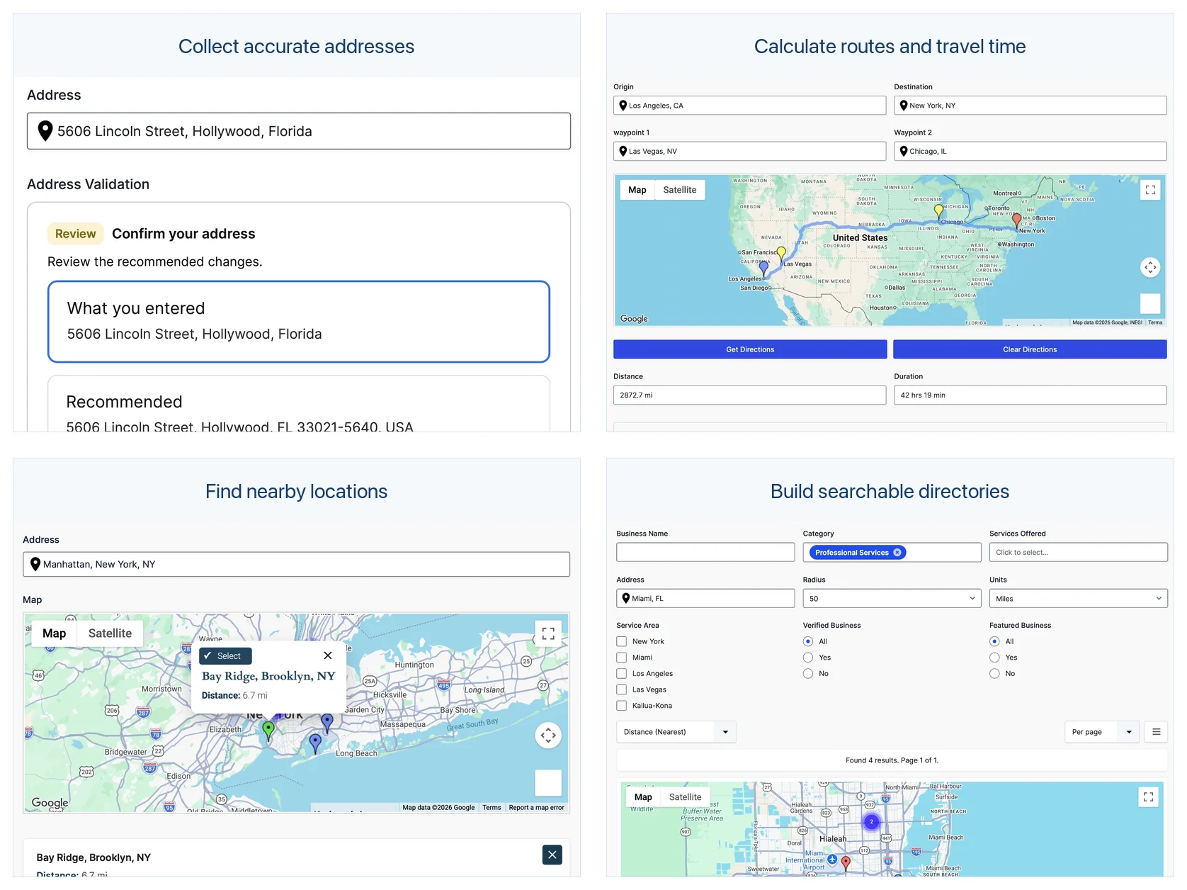
Collect Accurate Location Data
Gravity Location provides the core fields for collecting geographic data inside Gravity Forms:
- Address Field with Google address autocomplete
- Geocoder Field for synchronizing location data
- Map Field for selecting or adjusting a location visually
- Coordinates Field for latitude and longitude
- Current-location tools
- Reset Location controls
- Dynamic Location Data for passing location values into standard Gravity Forms fields
The related fields stay synchronized. Selecting an autocomplete suggestion can update the map and coordinates, moving the map marker can update the address, and detecting the visitor’s location can populate the connected fields automatically.
Gravity Geolocation 3.5 uses Places API (New) for address autocomplete. Make sure that service is enabled in the Google Cloud project connected to the plugin’s Browser API key.
Explore Gravity Location and its geolocation fields.
Validate and Standardize Addresses
Autocomplete helps visitors enter an address, but many workflows need an additional verification step before submission. The Address Validation Field can compare the entered address with a standardized recommendation from the Google Address Validation API.
Visitors can review the original and recommended addresses, accept the suggestion, or keep their original entry according to the form’s configuration. This is particularly useful for delivery, registration, booking, onboarding, membership, and service-request forms where incomplete or inconsistent address data creates work later.
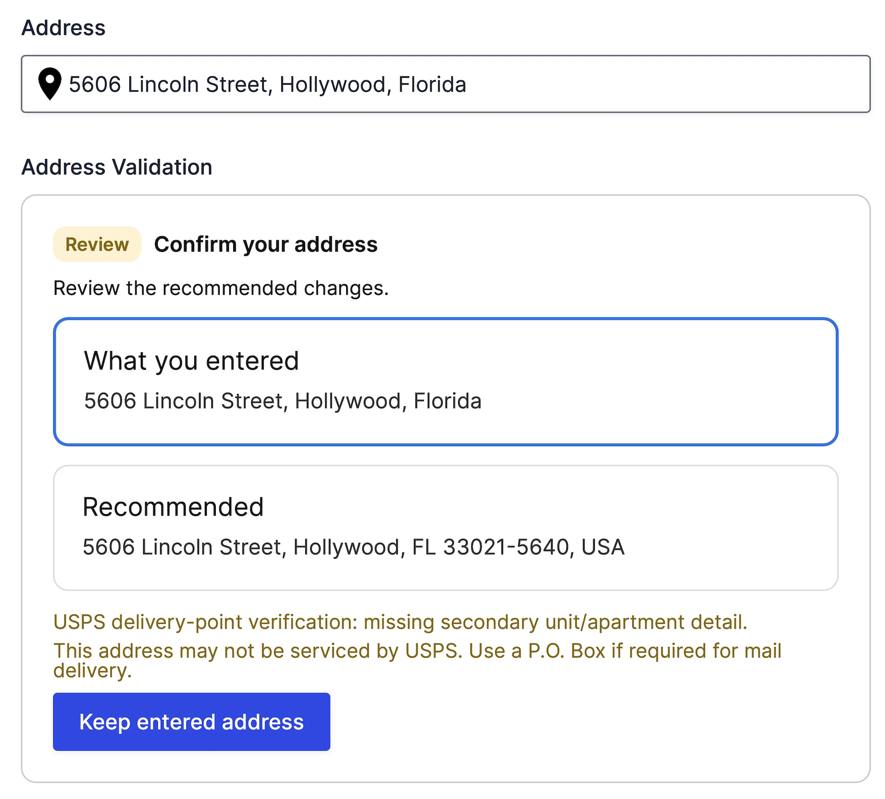
See how address validation works with Gravity Forms.
Calculate Distance, Duration, Routes, and Directions
Gravity Geolocation 3.5 separates simple travel calculations from complete route presentation so you can build the workflow your project actually needs.
The Distance & Duration Field calculates travel distance and estimated travel time between locations. Its output can populate compatible Gravity Forms fields for delivery fees, service pricing, mileage calculations, conditional logic, notifications, confirmations, merge tags, and feeds.
For a complete routing experience, the Directions Field supports routes between two or more form locations. Connect it to a Map Field to display the route, and use the Directions Panel to show turn-by-turn instructions.
Route-based distance and directions in Gravity Geolocation 3.5 use Google’s Routes API. Existing Google Cloud projects that previously relied only on Directions API must also enable Routes API.
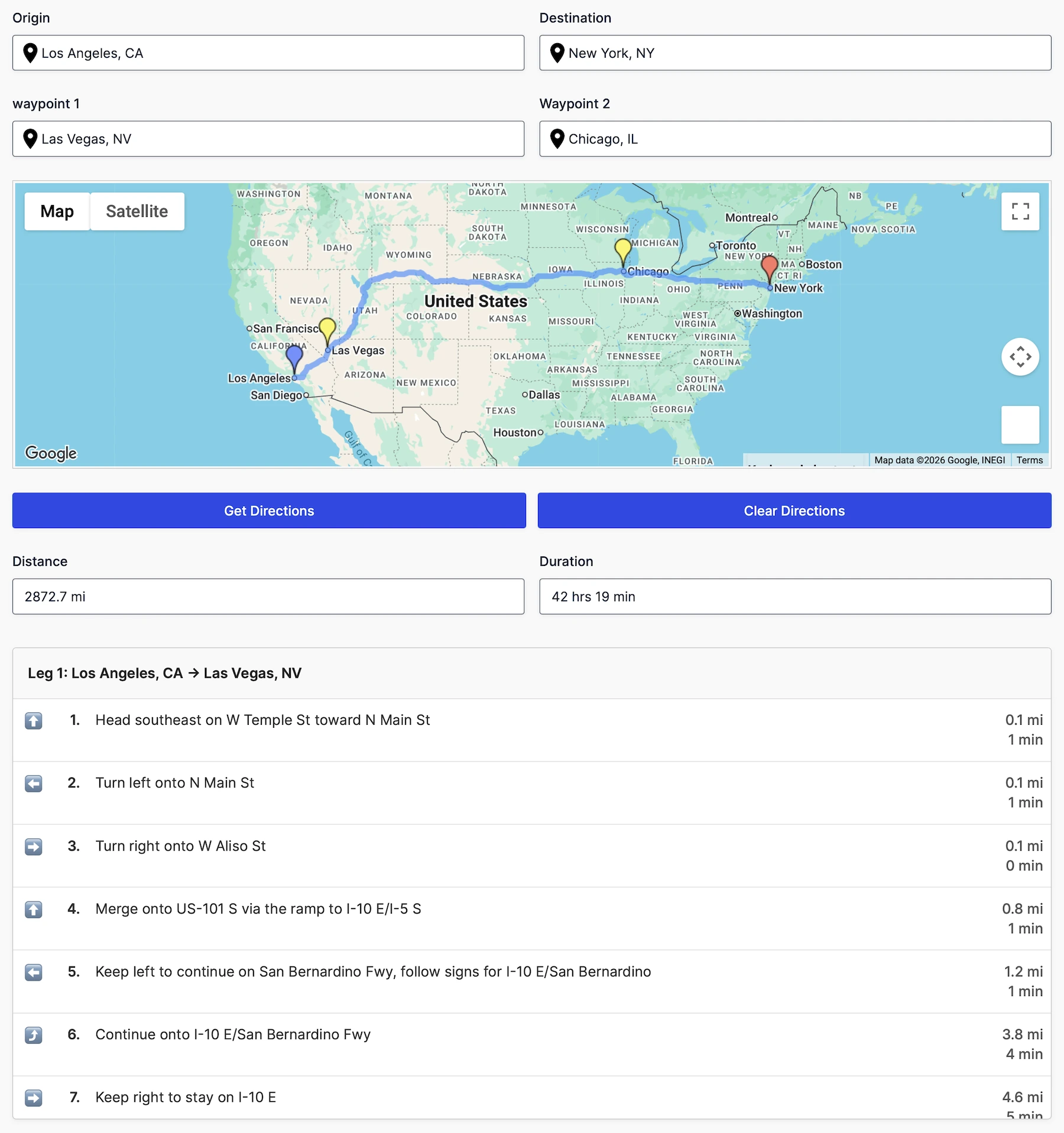
Explore Gravity Directions or try the distance and price-calculation demo.
Find the Nearest Location
The Nearest Locations Field compares a visitor’s location with a configured set of destinations and identifies the closest matches. Locations can come from manually configured data or a compatible database table.
Display the matching locations as map markers, let the visitor choose one, and pass selected-location values into standard Gravity Forms fields. This makes it possible to build nearest-store, branch, office, dealer, technician, provider, or pickup-location workflows directly inside a form.
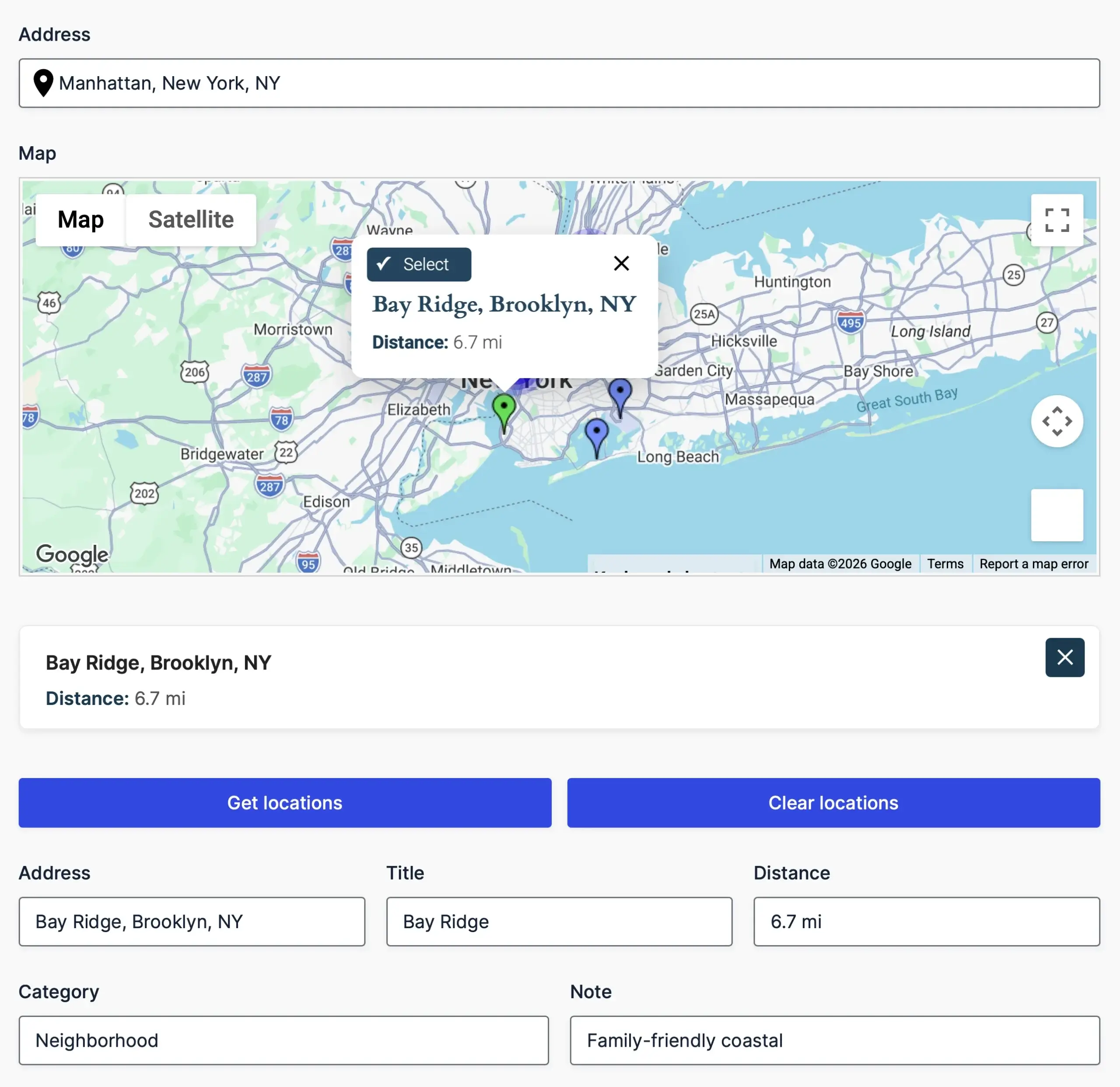
Explore the Nearest Locations solution.
Draw Service Areas, Boundaries, and Shapes
Drawing Tools let visitors create and edit geographic shapes on a connected map. Forms can collect points, lines, polygons, rectangles, circles, and freehand shapes together with their geographic data and measurements.
Use these fields for delivery zones, service regions, property boundaries, coverage areas, proposed routes, inspection areas, and other workflows where a single marker is not enough.
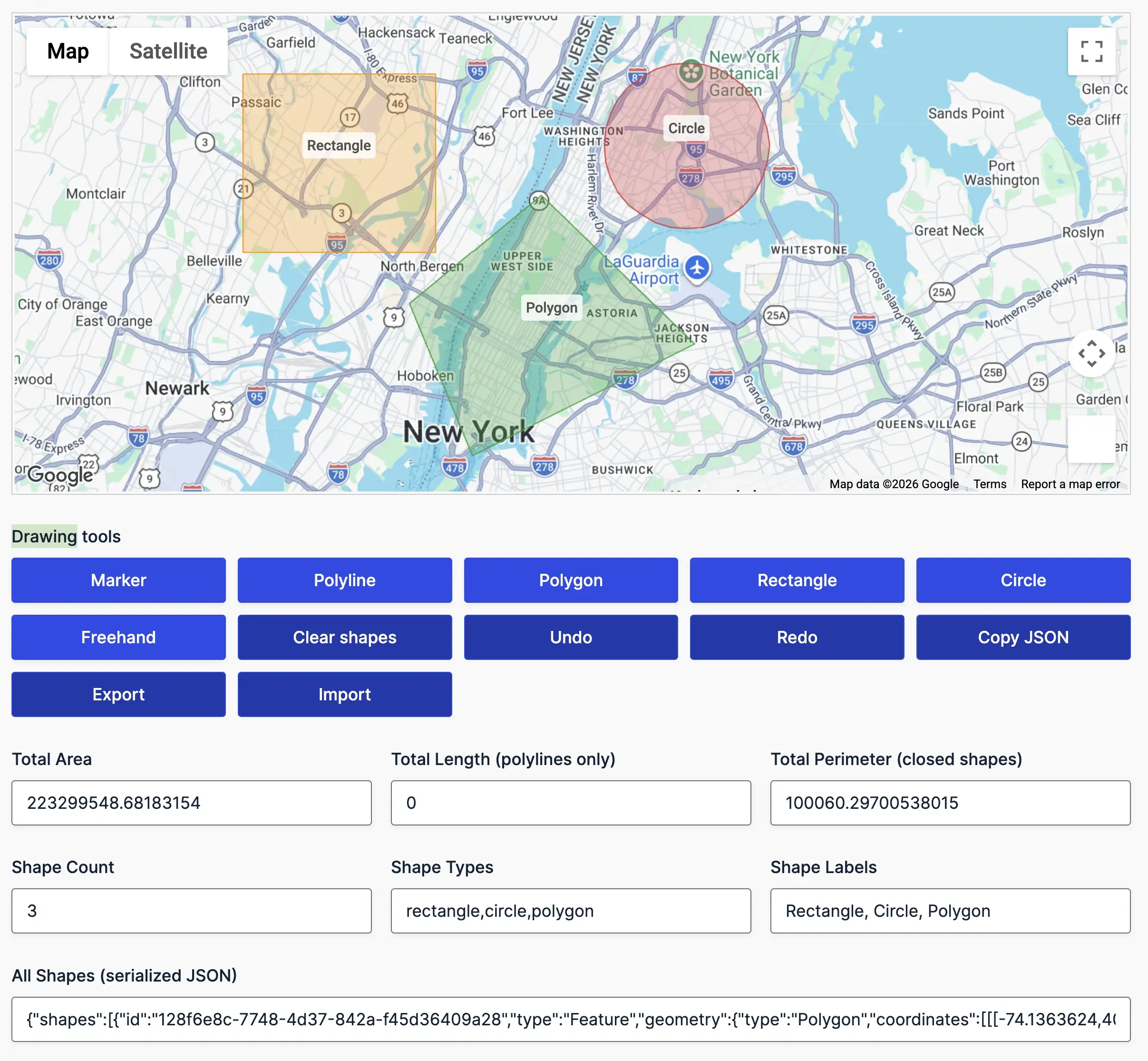
See Drawing Tools and Shape Fields.
Display Submitted Entries on Maps
Version 3.5 includes two focused ways to display saved Gravity Forms entries through Gravity Maps:
- Single Entry Map: display a location from one Gravity Forms entry, together with selected entry details.
- Mashup Map: bring locations from multiple entries together on one map with custom markers, information windows, and marker clustering.
These entry-display maps are different from the Map Field used inside a form. The Map Field helps a visitor select a location while completing a form; Single Entry and Mashup Maps display locations that have already been submitted.
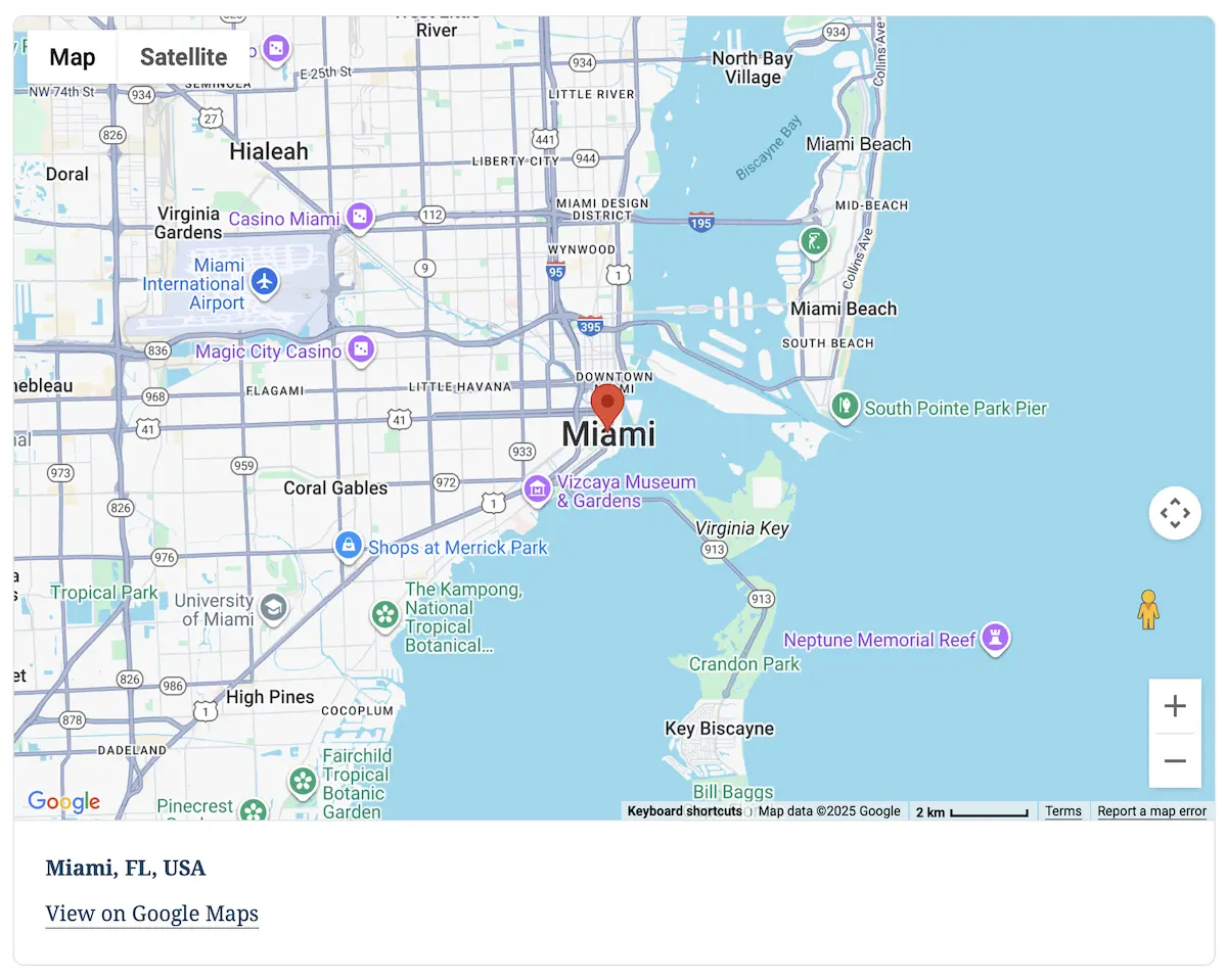
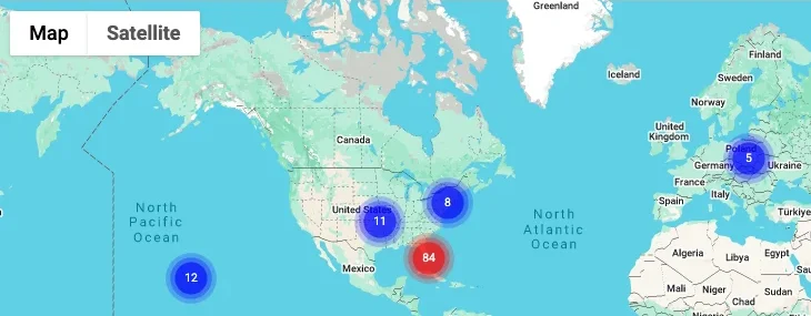
Explore Gravity Maps or read the Mashup Map documentation.
Search, Filter, and Display Entries with Gravity Search
Gravity Search is the frontend search-and-display product in the Gravity Geolocation family. It works directly with existing Gravity Forms entries and can display them as cards, lists, grids, tables, map markers, and dedicated entry details pages.
A Search connects to a Target Form containing the entries. Visitor-facing search fields are optional: you can build an interactive directory with filters, or create a predefined entry display with no visible search form.
Use Gravity Search to build:
- Business and member directories
- Store, branch, and dealer locators
- Property and resource listings
- Customer portals and internal record displays
- Map-first and proximity-search experiences

Explore Gravity Search or view the live demos.
A New Package Structure for Different Types of Projects
Version 3.5 introduces a clearer package structure based on what you are building:
- Gravity Location: collect addresses, coordinates, map-selected locations, and users’ current positions.
- Gravity Directions: calculate distance and travel time, display routes, and provide directions.
- Gravity Geolocation Toolkit: get all form-focused geolocation features, including Location, Directions, Address Validation, Nearest Locations, Drawing Tools, Single Entry Map, and Mashup Map.
- Gravity Search: search, filter, map, and display Gravity Forms entries on the frontend.
- All Access: combine the complete Geolocation Toolkit with Gravity Search in one plugin package and license.
The focused packages are alternatives for projects with a specific job. Gravity Location and Gravity Directions are sibling products; neither is intended to be a limited version of the other. Toolkit and All Access serve broader projects that combine multiple workflows.
Existing customers retain their existing license terms and entitlements. Visit your account for the package available to your license rather than choosing a download solely because its name resembles an older plan.
Compare the Gravity Geolocation packages.
Rebuilt on WPGeo Framework
Gravity Geolocation 3.5 is powered by the embedded WPGeo Framework. The framework provides the shared runtime behind geocoding, maps, location data, routing services, package capabilities, and account integration.
It is bundled inside Gravity Geolocation, so customers do not need to install a separate framework plugin. The new architecture also gives the product family a stronger foundation for future improvements across Gravity Geolocation and Gravity Search.
Get Started with Gravity Geolocation 3.5
Gravity Geolocation 3.5.1 is available from your account. Enable Places API (New) and Routes API for complete 3.5 functionality. The temporary legacy fallbacks in 3.5.1 are limited to existing Address Autocomplete and Directions fields and are intended only to keep those forms working while you update the Google Cloud project.
- View the complete Gravity Geolocation 3.5 release notes
- Compare packages and pricing
- Try the interactive demos
- Browse the documentation
- Contact support
We have spent a long time rebuilding this release and testing the new workflows. If you use Gravity Geolocation 3.5, we would love to hear what you build with it and which workflows you would like to see demonstrated next.